TTS14 to Zambia, Botswana, Namibia and South Africa
The Traveling School is a non-profit school dedicated to academic inspiration, outdoor skill development, overseas exploration, and a deeper comprehension of the world we live in.
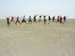
1, 2, 3 . . . . JUMP!

Namibian Salt Pan
Saturday, September 5, 2009
Bird's eye view
Hi Folks, Gary and I have been having fun looking at satelite images of Lake Kariba . We used Virtual Globetrotter and were able to find the airport in Lukasa. We then scanned south and found the lake. You can get a good look at the shoreline. We were also able to see Victora Falls. Pretty amazing !!!
Subscribe to:
Post Comments (Atom)


Hi All, I used Google Earth to look at the Lake it is huge! The story is that the lake was built to help bring power to Zambia and what used to be Rodesia but is now Zimbabwe. The first dam was built then a huge flood came and washed it out so they built a better dam but there has never been any eletricity come from the dam as he locals kept tearing down the power lines as they did not want them. So the officials finally gave up! Thank you for the tips! Kim Colvin
ReplyDelete